


While the Appalachian Trail may span 2,200 miles across fourteen different states, you don’t have to travel far to experience the trail’s natural wonders. Great Smoky Mountains National Park claims almost 71-miles of some of the trail's best scenic points, making Gatlinburg an ideal location for discovering one of America’s most famous trails. Here are a few AT routes you can conquer right now.
Hiking Via Clingmans Dome
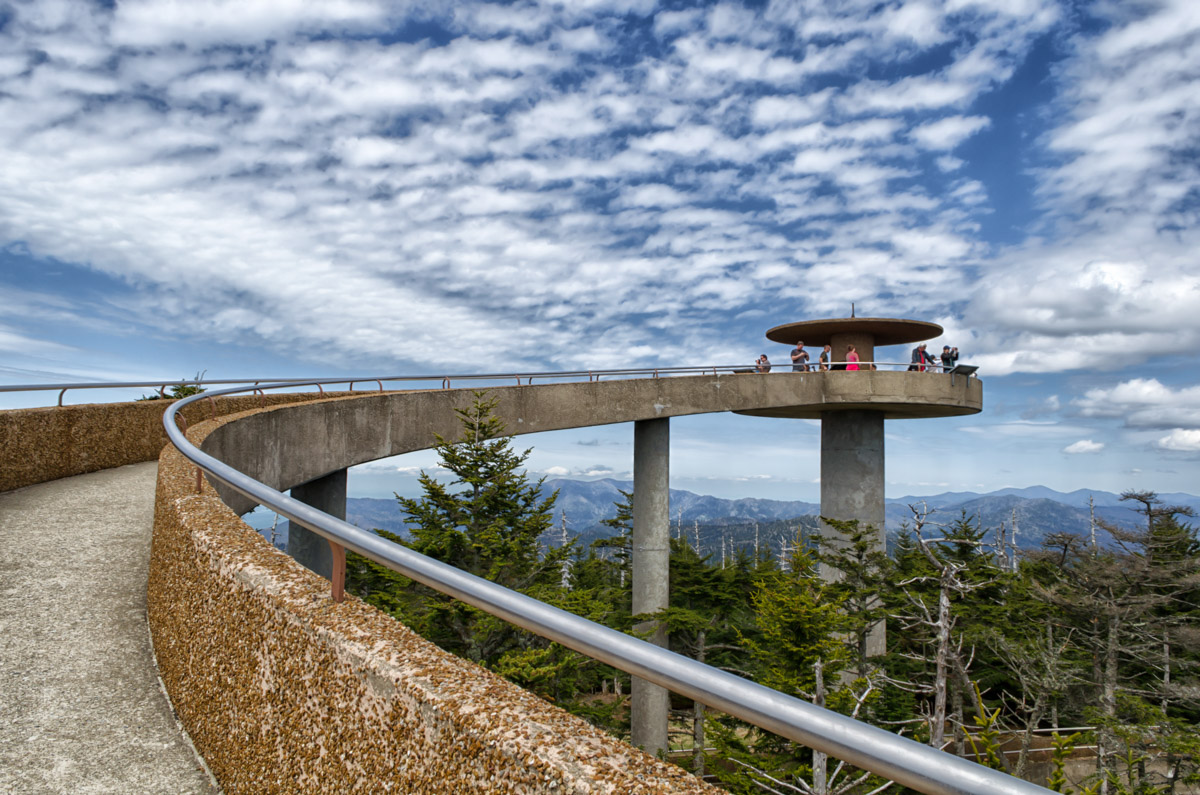
Coming in at 6,643 feet, Clingmans Dome is the highest point along the Appalachian Trail and the second highest peak east of the Mississippi River. Whether you are ending your hike at Clingmans Dome or just beginning it, there is plenty of beautiful vegetation and wildlife to see along the way. The Appalachian Trail via Clingmans Dome intersects with several surrounding trails with notable landmarks, allowing for shorter but equally scenic routes. The drive up to Clingmans Dome offers panoramic views from its observation tower, which is but a short distance from the area’s parking lot. Head up on a clear day and see rolling blue ridges that stretch into seven different states.
The road to Clingmans Dome is usually driven by visitors but hiking the 7-mile route is also an option. Challenging and rewarding, the walk offers stupendous views and connects directly with the half-mile path leading to the observation tower. It should be noted that this last half mile is steep and may prove challenging for visitors pushing strollers or have difficulty walking.
Clingmans Dome is open year-round but access to the road is closed from December 1 through March 31. Pets and bikes are not permitted in this area, although visitors can park their bikes near the beginning of the half-mile paved trail to the observation tower.
Hike from Newfound Gap to Charlies Bunion
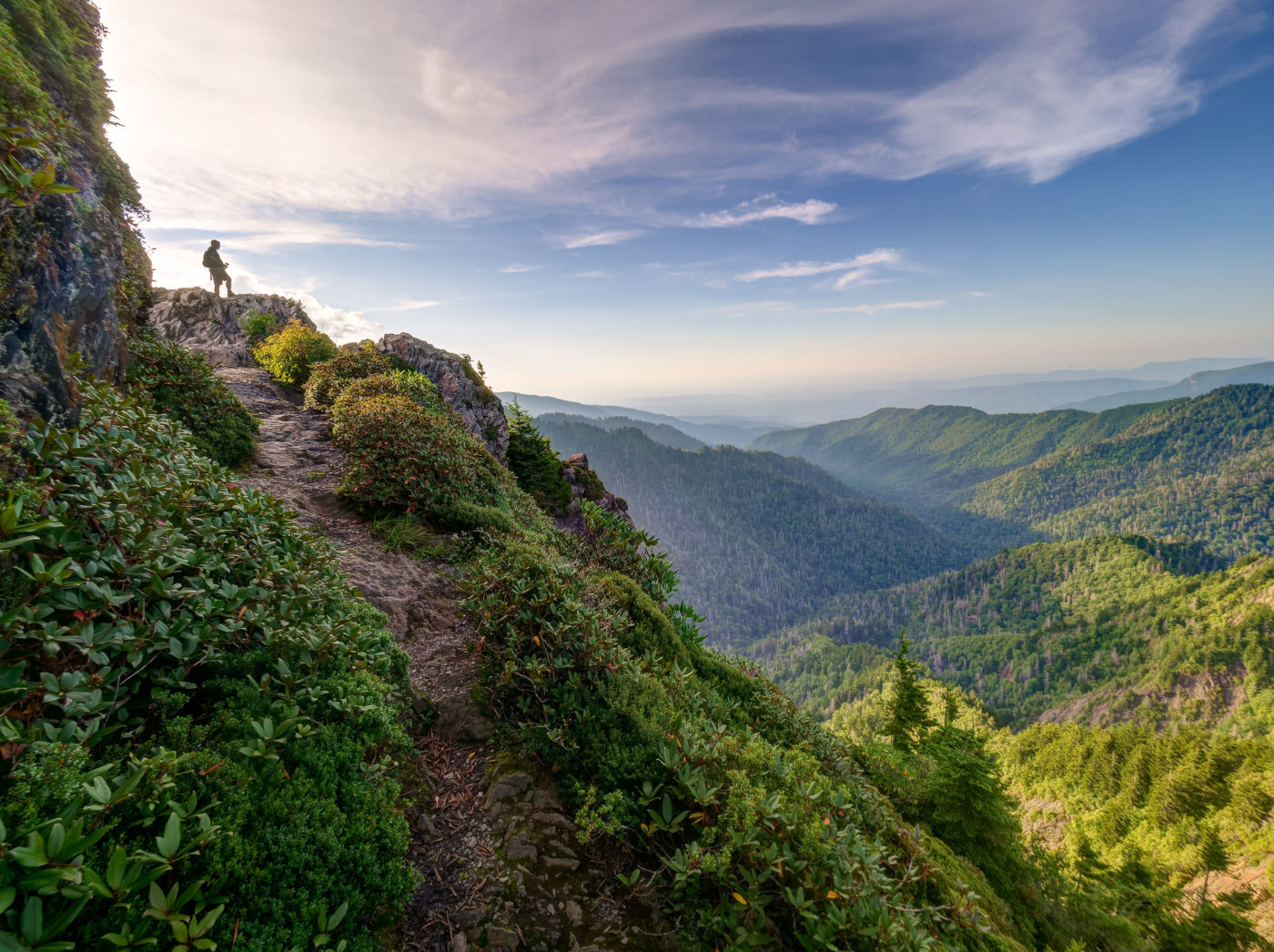
This popular 8-mile round trip is worth every step as you enjoy the trails astonishing views and local wildflowers along the way. To get there, follow the Newfound Gap Road to the Newfound Gap parking lot. The trail begins at the end of the parking lot, which is located near the restrooms. The trail will then lead you up 1600 feet along a ridge shrouded with rich vegetation. Be sure to wear proper footwear so that you might easily traverse across the trail’s wet rocks and wood logs.
The highlight of the hike lies at the trail’s end, where gorgeous mountain views open up from the seat of Charlies Bunion, a large bare-rock summit named after mountain guide Charles Connor, who stopped at the overlapping edge to tend to his swollen foot. Hikers who hike this path will enjoy knowing that they travel along a line between Tennessee and North Carolina. Warmer seasons are the best time to visit Charlies Bunion, as winter sometimes creates icy and challenging conditions along the trail. If you want to add to your adventure, hike the extra mile to the Jump Off and you will be rewarded with breathtaking views as far as the eye can see. The Jump Off area offers stunning photographic opportunities and is a must-do for those who want to have the complete Charlies Bunion experience.
Have you hiked the A.T. in our area? Share your experiences with us on our social.


