Alum Cave Trail
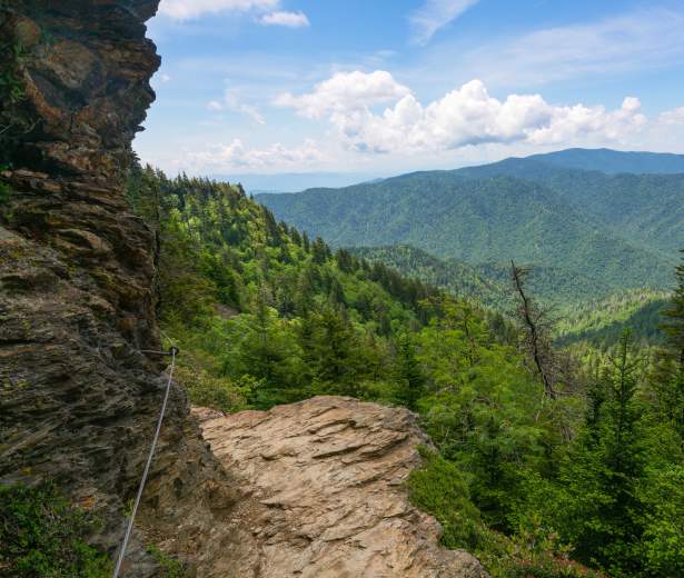
The trail begins by crossing Walker Camp Prong and Alum Cave Creek on log bridges, leading hikers through an old-growth hardwood forest. A highlight on this hike, is a short climb through the narrow tunnel of Arch Rock. As the trail continues to climb up Peregrine Peak, it approaches a heath bald full of mountain laurel and rhododendron, finally reaching a rocky outcrop known as Inspiration Point at around 2 miles. This is a good place to view the rugged valley while surrounded by mountains. The Alum Cave Bluffs are 2.3 miles from the trailhead. Although the ground is dry underneath the bluffs, the air and ground outside of it are wet. Many turn around at this point, but continue on the trail for another 3.2 miles to the summit of Mount LeConte to be rewarded with sweeping vistas seen from exposed cliffs as the trail climbs to the top.
Please keep in mind bicycles and dogs are NOT allowed on this trail and a parking pass is required when parking longer than 15 minutes at the trailhead.
Trail Info:
Region: Newfound Gap
Length: 5.5 miles (one-way)
Rated: Hard
Elevation Gain: 3,061 ft
Route Type: Out & Back or Point-to-Point
Features:
Forest, River, Wildlife, Popular, Views
Directions
Drive 8.6 miles on Newfound Gap Road from Sugarlands Visitor Center or 20 miles from Oconaluftee Visitor Center. There is a sign and two large parking areas marking the trailhead.
Trail Map
Discover More in The Smokies
NATURE SPOTLIGHT
5 Ways to Celebrate Father’s Day in Gatlinburg
It’s that time of the year to celebrate the man, the myth, the legend… and to...
Family Fun Picnic Spots in the Smokies
See original post. Above photo by Michele Sons If you spend much time at all in Great Smoky...
Biking in the Smokies
See Original post. Above photo by Carter Rutledge It can be hard to find a place to bike in...
Explore Gatlinburg’s Most Historic Places
Many Gatlinburg natives never tire of telling just how this mountain town came to be. From...


