Abrams Falls Trail
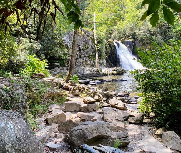
The five-mile round trip along Abrams Creek is a moderate hike that’s worth every step. Cross the wooden bridge, and follow the path along the Cades Cove Valley floor among pine, oak, hemlock and rhododendron. When you arrive, you’ll see why a waterfall that’s only 20 feet high is one of the most popular places in the Smokies. The amount of rushing water is staggering, and the pool below it is long and deep. The warnings about swimming are worth heeding! The currents here are dangerous and have swept some to their deaths.
Please keep in mind bicycles and dogs are NOT allowed on this trail and a parking pass is required when parking longer than 15 minutes at the trailhead.
Trail Info:
Region: Cades Cove/Townsend
Length: 4.2 miles (one-way)
Rated: Moderate
Elevation Gain: 629 ft
Route Type: Out & Back or Point-to-Point
Features:
Hiking, Waterfall, Forest, River, Wildflowers, Wildlife, Rocky, No Dogs, Popular, Restrooms
Directions
To access Roaring Fork, turn off the main parkway in Gatlinburg, TN at traffic light #8 and follow Historic Nature Trail Road to the Cherokee Orchard entrance to the national park. Just beyond the Rainbow Falls trailhead, you have the option of taking the one-way Roaring Fork Motor Nature Trail (closed in winter). Please note that buses, trailers, and motor homes are not permitted on the motor nature trail.
Preview Trail
Trail Map
Discover More in The Smokies
NATURE BLOGS
5 Ways to Celebrate Father’s Day in Gatlinburg
It’s that time of the year to celebrate the man, the myth, the legend… and to...
Family Fun Picnic Spots in the Smokies
See original post. Above photo by Michele Sons If you spend much time at all in Great Smoky...
Biking in the Smokies
See Original post. Above photo by Carter Rutledge It can be hard to find a place to bike in...
Explore Gatlinburg’s Most Historic Places
Many Gatlinburg natives never tire of telling just how this mountain town came to be. From...
